Will snowmelt, rainfall, or saturated soil result in potential runoff from your crop fields? The Wisconsin Runoff Risk Advisory Forecast (RRAF) is a web-based tool to help you predict manure runoff potential on a very local level (2.0km x 2.0km grids or 6.56 ft x 6.56 ft). It is easy to use the RRAF, just follow these 4 steps:
1. Visit the Website and Check the Color on the Map
Visit the RRAF website. The main webpage displays a map of Wisconsin color coded by runoff risk.
The runoff risk categories are based on the model’s many years of historical weather data, calibrated against real world, edge-of-field monitoring data. Here is what each color category means:
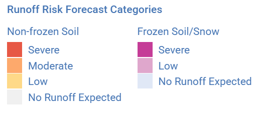
The Golden Rule
“If it’s RED, do not SPREAD.”
Non-frozen Soil
When the soil is not frozen you could see a range of risk from no runoff expected to severe risk. The RRAF tool looks out three days into the future to determine the potential risk.
Frozen or Snow Covered Soil
When soil is frozen or snow-covered, the RRAF looks out 10 days into the future because applications are applied to the surface during this time, and even a small runoff event can wash away large amounts of applied nutrients, like manure.
2. Plan and Use the “Look Ahead” Feature
The RRAF map is updated four times a day and allows for short term planning. It displays the current day’s risk and uses precipitation model forecasts to predict risk for the next three days. During the winter, the model uses temperature forecasts to look up to 10 days ahead to predict potential snowmelt, a major factor in winter runoff.
The date slider, located below the map in RRAF, allows you to view the forecast for five days.
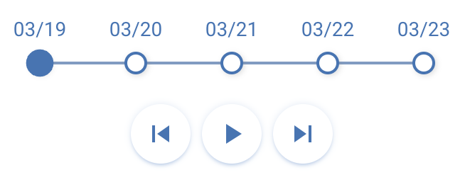
A multi-day forecast is used, rather than a single-day forecast, to help prevent manure applications on days before runoff triggering events.
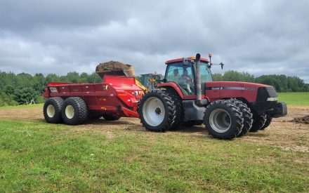
Manure applied today could runoff with tomorrow’s rain or snowmelt!
3. Get Local Forecast Details
You can get runoff risk data specific to your farm fields by following these steps:
1. Click the “Get Forecast Details” button.

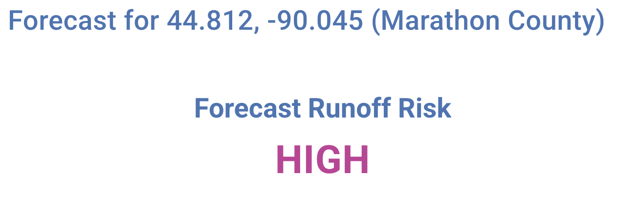
2. Hover over the map and select a location on your farm by clicking directly on the map or entering an address in the search bar.

3. The forecast will show the selected location’s coordinates, county name, and the current runoff risk (e.g., Low, Moderate, Severe).
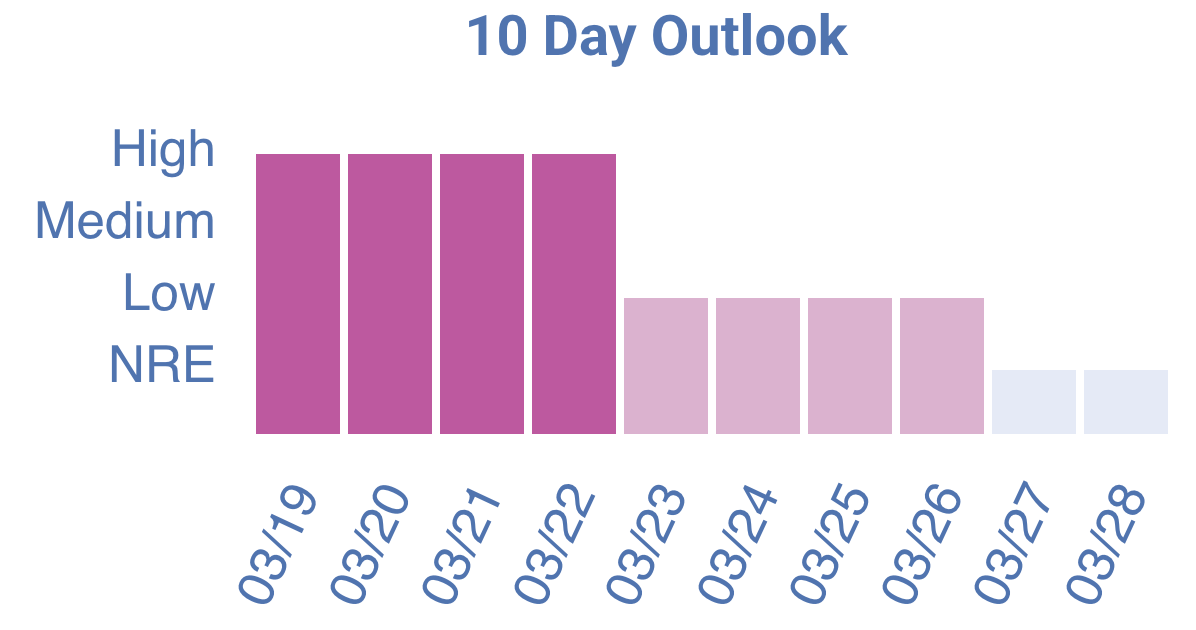
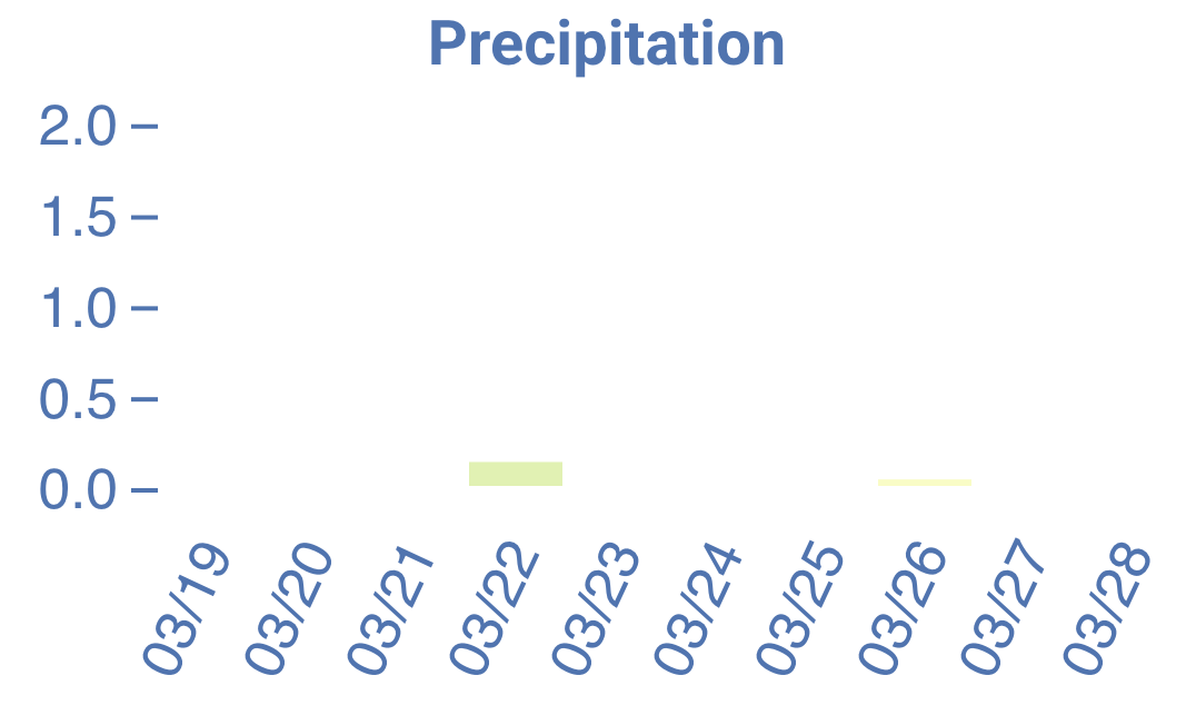
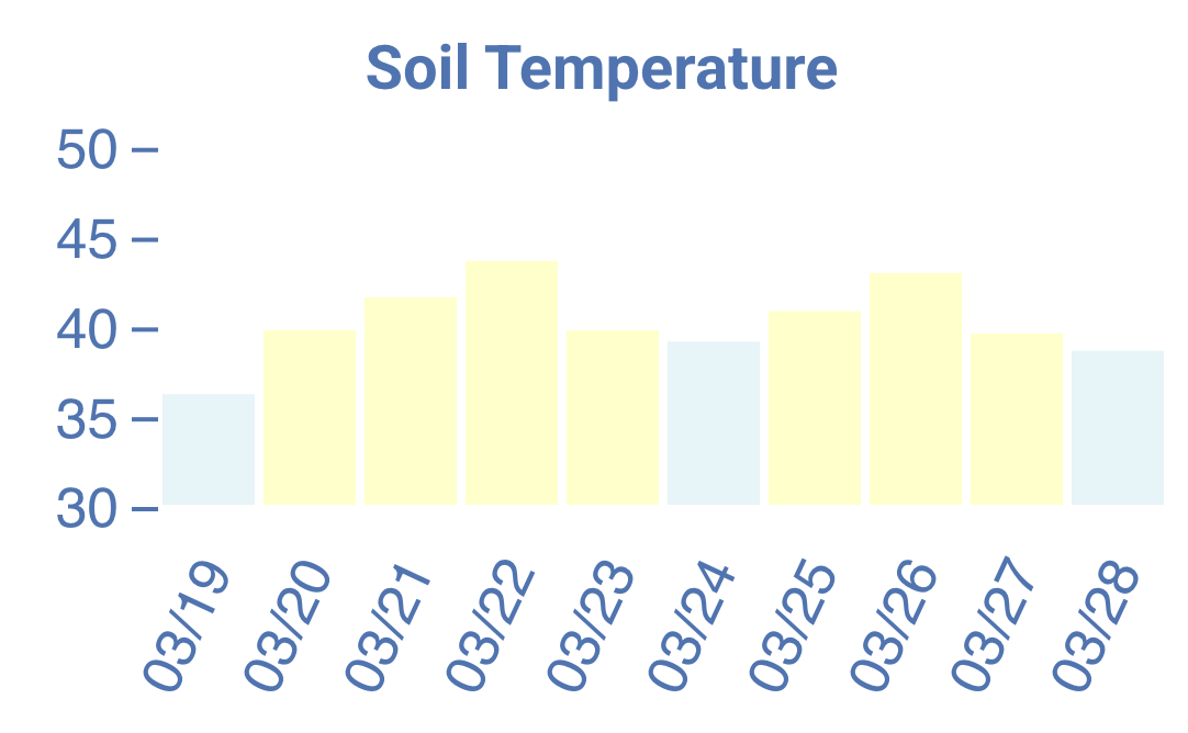
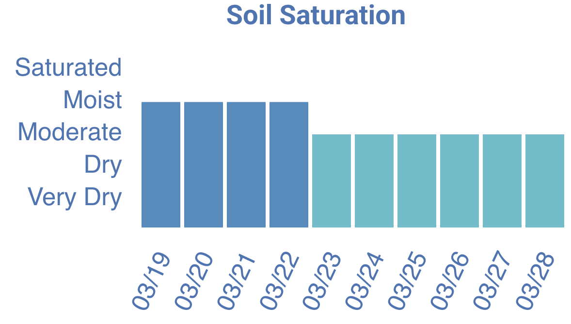
RRAF will also show 10-day outlooks for runoff risk, precipitation, soil temperature, and soil saturation. Example graphs are shown below.
4. Helpful Resources
Historical Data
Use the Historical Snapshots button on the top right of the website to look back at past runoff risk data. Enter the date and download the maps for your records.

If you must spread or empty a storage, but the forecast indicates a severe runoff risk, the review RRAF’s guidance about spreading on high-risk days. You should also contact your nutrient management planner and local county land and water conservation department or DNR specialist (for WPDESP permit holders) to discuss options. By assessing these factors – soil moisture, weather forecasts, crop cover, and slope – the RRAF helps you avoid runoff problems before they occur.
More Information
For more information on using RRAF and manure spreading, check out this short video: ▶ Tools for Planning and Spreading Manure – Crops and Soils.
Reviewed by: Andrea Topper and Kevin Erb